Modeling water futures: how climate change and deforestation are draining the Chiquitania

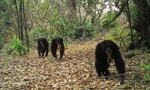
Critical minerals and the western chimpanzee: how bauxite…
24 March, 2026
Thursday 15 january 2026
The Chiquitano Forest, a 23-million-hectare tropical dry forest spanning eastern Bolivia and western Brazil, is one of South America’s most unique ecosystems[1]https://elproyectoesperanza.com/2020/medio-ambiente/ecocidio-en-la-chiquitania-boliviana/. Home to over 3,000 plant species and 1,200 vertebrate species, including jaguars and giant anteaters, it provides critical ecosystem services for approximately 3 million people, including Indigenous peoples, local communities, small-scale farmers, and agribusiness operations[2]https://www.mdpi.com/2071-1050/16/3/969.
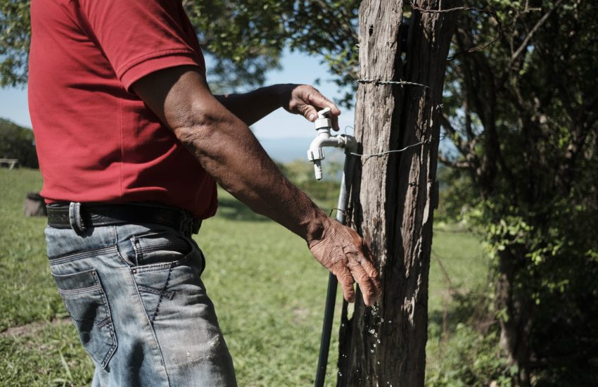
Header photo: A man drawing water to use in his garden. © Manuel Seoane / IUCN NL
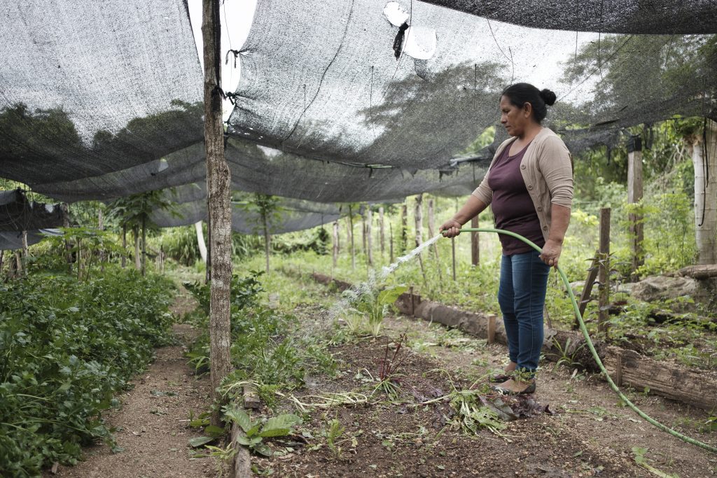
However, this forest is more than a biodiversity hotspot; it’s living water infrastructure. Through their root systems, the forests absorb rainfall stored in soils and release it gradually through evapotranspiration, helping regulate local rainfall patterns and maintain river and groundwater flows during the dry season. This hydrological function is especially critical in tropical dry forests like the Chiquitania, where seasonal water scarcity is already a defining characteristic of life.
Yet this natural water system is unraveling. By 2022, total deforestation in the Chiquitano Forest reached 2.8 million hectares (39% of Bolivia’s total forest loss), primarily due to agricultural conversion for soy cultivation and cattle ranching[2]. As community leader Dyana from San Rafael warns: ‘Without forest, there is no water.’
Understanding water stress through modeling
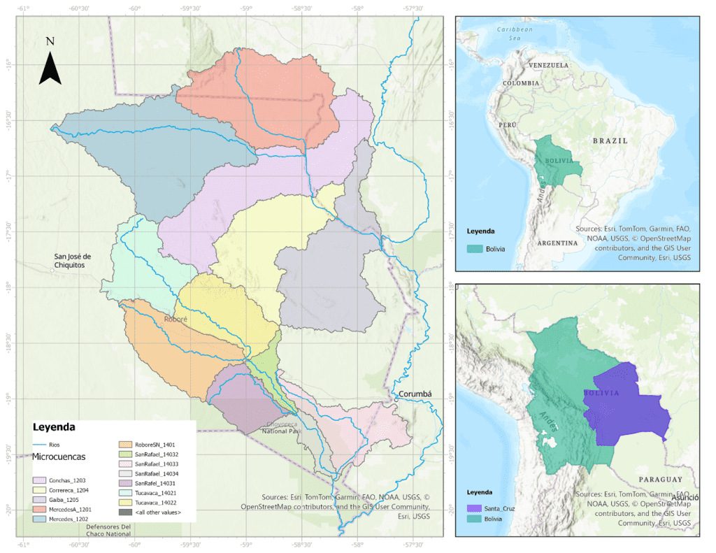
To understand how climate change and land-use change are reshaping water availability in the Chiquitania, IUCN NL partnered with the Stockholm Environment Institute to develop a comprehensive hydrological model of the Tucavaca-Curichi Grande basin. This 79,640 km² watershed drains into the upper Paraguay River basin, forming a critical transition zone between the Chiquitano dry forest and the Bolivian Pantanal wetlands.
Using the Water Evaluation and Planning (WEAP) system, researchers integrated historical climate data (1980-2020), global climate projections from the Intergovernmental Panel on Climate Change’s Sixth Assessment Report, land cover analysis, and water demand estimates for both domestic and livestock use. The model reveals how declining rainfall, rising temperatures, and rapid agricultural expansion interact to reduce water availability for communities and ecosystems.
A drying trajectory
The data paints a concerning picture. Since the 1980s, average annual rainfall has decreased by 33.5 mm per decade in the Curichi Grande sub-basin and 5.5 mm per decade in Tucavaca, while temperatures have risen approximately 0.2°C per decade across both areas. This rainfall volume reduction its significant for a vulnerable ecosystem like the Chiquitano forest.
Climate projections for the period 2041-2060 show these trends accelerating under a high-emissions scenario (Shared Socioeconomic Pathway (SSP) 5-8.5 [3]Shared Socioeconomic Pathway (SSP) 5-8.5 represents a future scenario with continued high fossil fuel use, limited climate mitigation efforts, and substantial greenhouse gas emissions, resulting in … Continue reading). This scenario assumes continued fossil fuel dependence and limited climate action.
Climate projections 2041-2060
Climate projections for the period 2041-2060 show these trends accelerating under a high-emissions scenario (Shared Socioeconomic Pathway (SSP) 5-8.5 [4]Shared Socioeconomic Pathway (SSP) 5-8.5 represents a future scenario with continued high fossil fuel use, limited climate mitigation efforts, and substantial greenhouse gas emissions, resulting in … Continue reading). This scenario assumes continued fossil fuel dependence and limited climate action.
- Trend scenario: 4.8% decline in precipitation with a 2.0°C temperature increase.
- Very dry scenario: 22.5% decline in precipitation with a 2.0°C temperature increase.
- Dry and warm scenario: 18% decline in precipitation with a 3.5°C temperature increase.

The Shared Socioeconomic Pathways explained
In reports by the Intergovernmental Panel on Climate Change (IPCC), “scenarios” are standardised future pathways used to explore possible climates under different human development and emissions choices. In IPCC’s Sixth Assessment Report, the main framework is scenarios based on the Shared Socioeconomic Pathways (SSPs).
The five scenarios from the Sixth Assessment Report are:
- SSP1-1.9: very low emissions / strong mitigation pathway (which could keep us within the limit of 1.5°C of global warming).
- SSP1-2.6: low emissions / strong mitigation.
- SSP2-4.5: “middle-of-the-road” / intermediate pathway.
- SSP3-7.0: high emissions / fragmentation & slower development.
- SSP5-8.5: very high emissions / fossil-fuel intensive development pathway.
Reduced water availability
These changing conditions translate directly into reduced water availability. By mid-century under the driest scenario, river flows could drop significantly: Tucavaca could lose 89 m³/s (a 28% reduction) and Curichi Grande could lose 238 m³/s loss (a 32% reduction). To put this in perspective: a 100 m³/s reduction is equivalent to 100.000 liters per second, meaning approximately 2.4 Olympic pools can be filled in a minute.
Beyond surface flows, the model shows concerning declines in soil moisture, particularly in forest areas, resulting from both reduced precipitation and increased evaporation driven by higher temperatures. This moisture loss increases fire risk and threatens the forest’s capacity to regulate the water cycle, creating a dangerous feedback loop.
Land use change: amplifying the crisis
While climate change drives the overarching trend toward water scarcity, deforestation and agricultural expansion amplify local impacts in critical ways.
The model incorporated detailed analysis of land cover change using satellite data from 1992-2022, which confirmed forest cover as the dominant land type (65% of the basin). Notably, researchers also identified and mapped thousands of atajados, artificial ponds constructed by cattle ranchers to capture and store surface runoff water for livestock.
Using satellite imagery and water detection indices, the study documented atajados covering significant areas across municipalities in both Bolivia and Brazil. These structures store an estimated 31.6 million m³ of water regionally, equivalent to approximately 18.7% of total natural flow during of the basins during the dry season. While atajados provide critical water security for livestock operations during drought periods, they also retain water that would otherwise contribute to downstream river flows and groundwater recharge, creating potential conflicts with other water users.
‘Ecosystems like Bolivia’s Chiquitano dry forest are very complex, and models can only capture part of that reality especially where long-term ecological and hydrological data are limited. That means actual impacts are likely to be more severe.’
- Mariel Cabero, Expert Environmental Justice
When comparing different land-use scenarios to 2060, ranging from continued deforestation trends to conservation and restoration efforts, the model revealed that climate conditions dominate water supply changes. However, land-use scenarios still matter: the difference between a 10% forest loss scenario and a 10% forest gain scenario, though seemingly modest at 0.7 m³/s, equates to the annual water consumption of 4 million people.
Importantly, these findings emerged from a technical modeling exercise that could not incorporate detailed information on how fires alter soil properties or how unregulated atajado construction and groundwater extraction affects local hydrology, suggesting actual impacts may be even more severe than modeled.
Who pays the price?
The consequences of declining water availability fall disproportionately on those least responsible for causing the crisis.
For local communities
Reduced river flows and depleted aquifers mean increasing seasonal water scarcity. Communities already face interrupted access to water for household use and small-scale agriculture, with some requiring emergency water delivery by tanker trucks for several months each year. Women, who typically bear primary responsibility for water collection and household management, face increased workloads and reduced time for income-generating activities. The 2024 San Lorenzo River case, where communities successfully sued a cattle rancher for illegally diverting the river, exemplifies growing water conflicts between agribusiness operations and local water rights[5]https://anabolivia.org/por-orden-judicial-se-inicia-la-restitucion-del-cauce-del-rio-san-lorenzo-y-la-remocion-de-presa/.
For ecosystems
Lower flows threaten the ecological integrity of the Pantanal wetlands downstream, which depend on seasonal flooding from Chiquitania rivers. Reduced soil moisture increases forest vulnerability to fires, creating conditions for catastrophic fire seasons like those in 2019 and 2024. As forests degrade, their capacity to regulate the water cycle diminishes, accelerating the spiral toward ecosystem collapse.
For regional stability
Water scarcity threatens the viability of small-scale farming, driving rural-to-urban migration, and increasing pressure on already strained urban water systems. Competition for limited water resources between domestic use, livestock, and industrial agriculture intensifies social tensions and undermines regional food security.
Pathways forward: conservation as water policy
The modeling results offer clear guidance for policy and action:
1. Recognise forest conservation as water infrastructure investment
Every hectare of intact forest maintains infiltration capacity, regulates seasonal flows, and supports local rainfall generation. Protecting and restoring forests should be understood as an essential water management strategy, not merely as environmental conservation. Current policies promoting agricultural expansion fundamentally undermine water security[1].
2. Regulate decentralised water storage (atajados) and groundwater extraction at landscape scale
While atajados serve legitimate needs for livestock water supply, their cumulative impacts on downstream water availability require integrated planning and regulation. Water governance must account for these small structures that collectively alter basin hydrology, ensuring equitable water distribution between upstream and downstream users. In the same line, the unregulated ground water extraction in Chiquitania is putting community livelihoods and ecosystems at risk, therefore urgent monitoring and regulating interventions are needed, led by municipal authorities and also involve the private sector and community water committees.
3. Strengthen monitoring and adaptive management
The current scarcity of hydrometeorological monitoring stations limits understanding of actual conditions and constrains model calibration. Expanding monitoring networks (including flow measurements, groundwater levels, and meteorological data) would enable more accurate forecasting and responsive management.
4. Integrate local and scientific knowledge
This technical modeling study could not incorporate the lived experiences, traditional knowledge, and priorities of communities who directly experience water scarcity. Future research must adopt participatory approaches that co-create research questions, scenarios, and solutions with local communities, ensuring that technical tools serve locally defined needs and support community-led water governance.
5. Align climate adaptation with forest protection
As climate projections show intensifying water stress regardless of land-use scenarios, forest conservation becomes even more critical as the primary strategy for maintaining ecosystem resilience. Climate adaptation investments should prioritise forest protection, restoration, and sustainable management rather than infrastructure projects that may become obsolete as hydrological regimes shift.
Protecting forests is protecting water and lives
The Stockholm Environment Institute’s modeling work provides rigorous evidence of what community members already know from daily experience: deforestation is a water crisis. As forests disappear, so does the region’s capacity to buffer against climate change, store and filter water, and sustain the communities and ecosystems that depend on these services [6]https://www.sei.org/wp-content/uploads/2020/11/the-chiquitania-fires.pdf.
Bolivia’s aggressive agricultural expansion policies, including the “Patriotic Agenda 2025” targeting tripled livestock production, are on a collision course with water security and climate resilience[4]. With 1.75 million hectares deforested in 2024 alone, the country ranks among the global top three for forest loss, yet this destruction receives far less international attention than Amazon deforestation[7]https://www.globalforestwatch.org/dashboards/country/BOL/.
The evidence is clear: protecting the Chiquitano Forest is not a choice between conservation and development; it is a prerequisite for sustainable development. Water security, food security, climate resilience, and human rights are inseparable from forest protection in this critical ecosystem.
IUCN NL’s work for forests and climate
Through partnerships like our collaboration with the Stockholm Environment Institute and our support for local organisations, IUCN NL continues working toward more sustainable and inclusive management of tropical forests that supports climate adaptation, human rights, and the livelihoods of Indigenous peoples and local communities.
This work was conducted as part of IUCN NL’s Forests for a Just Future programme of the Green Livelihoods Alliance, with technical analysis by the Stockholm Environment Institute. The full technical report provides detailed methodology and results for water resource planners and researchers.
Read more about Chiquitania
Learn more? Contact our experts:


Index
| ↑1 | https://elproyectoesperanza.com/2020/medio-ambiente/ecocidio-en-la-chiquitania-boliviana/ |
|---|---|
| ↑2 | https://www.mdpi.com/2071-1050/16/3/969 |
| ↑3, ↑4 | Shared Socioeconomic Pathway (SSP) 5-8.5 represents a future scenario with continued high fossil fuel use, limited climate mitigation efforts, and substantial greenhouse gas emissions, resulting in approximately 4-5°C global warming by 2100. |
| ↑5 | https://anabolivia.org/por-orden-judicial-se-inicia-la-restitucion-del-cauce-del-rio-san-lorenzo-y-la-remocion-de-presa/ |
| ↑6 | https://www.sei.org/wp-content/uploads/2020/11/the-chiquitania-fires.pdf |
| ↑7 | https://www.globalforestwatch.org/dashboards/country/BOL/ |

27 March, 2026
Engaging Stakeholders to Advance Ecosystem-based Adaptation in Mauritius
Madagascar and the Indian ocean islands are a biodiversity hotspot - a group of islands with incredible species diversity and…
24 March, 2026
Critical minerals and the western chimpanzee: how bauxite mining threatens one of West Africa’s last strongholds
In West Africa, the global scramble for critical minerals’ is putting immense pressure on unique ecosystems. As the demand for…