Meet the conservationist: Anne-Isabelle Bonifassi
23 July, 2026
Meet the conservationist: Anne-Isabelle Bonifassi
23 July, 2026
Wednesday 16 may 2018
Header photo by: CC0 Burnt Pineapple Productions via Flickr
To secure ecosystem-based goods -such as climate resilience, food security and water provisioning- civil society organizations (CSOs), governments and businesses should use available information about land use locations and landscape geography in order to make optimal trade-offs in spatial planning.
Since the last decade, the big data revolution and the launch of high-tech, freely available near-real time satellite images, have been catalyzing a worldwide revolution in the use and application of geospatial information. This revolution is expected to lead to more accurate, frequently updated, high resolution, user friendly, web-based, three-dimensional land cover modelling. Initiators of landscape initiatives should keep a close-eye on these developments, as they provide great opportunities to facilitate the alignment of social, economic and environmental goals for sustainable development.
Natural capital can best be managed if we know where it is located in relation to its users. To understand the impacts and dependencies of indigenous communities, urban citizens, farmers, and other land users of natural assets in a landscape, spatial data are required. When modelled in a land use map, earth observation data from satellites can prove a powerful piece of objective information. Such land use maps can act as communication tools that transcends language and culture by grouping each land occupation into separate classes. When layered with other social and environmental information and attributes, complex issues can be understood within seconds and problem areas can be identified instantly.
When organizing multi-stakeholder platforms in order to secure ecosystems and the services they provide us with, spatial information on land use is fundamental to achieving a shared understanding of landscape conditions, challenges and opportunities. Knowing what is happening where and when in a landscape enables collaborative spatial planning to develop an agreed action plan. Moreover, after stakeholders have implemented the plan, an updated land use map can function as a monitoring tool to assess whether collaborative commitments have been maintained, or to determine if adaptions need to be made on the design of the agreed action plan.
Despite being a useful tool, the use of geographical information in landscape processes has not yet lived up to its potential. CSOs are often using only a tiny fraction of the analysis possibilities that satellite images and geospatial information system toolboxes offer. IUCN NL therefore increases the knowledge of its Southern CSO partners about the opportunities that geospatial data offers and stimulates them to work with land cover maps during their landscape planning processes. This way, we aim to embed the use of land use maps in decision-making processes to secure climate resilience, water provision and food security.
Our partner organizations in the Philippines used land cover time series of Palawan to gather evidence of unauthorized expansion of monoculture cropping to secure primary forest. In Uganda, our partners improved their conservation strategies when land cover maps of the landscape around Murchison Falls National Park highlighted the expansion of sugar cane plantations and the significance of smallholder farming. These examples illustrate the value of geographical information in efforts to align different land uses for sustainable development. By embedding land use maps in landscape planning, the process to reach joint solutions for sustainable development becomes a lot easier.

23 July, 2026
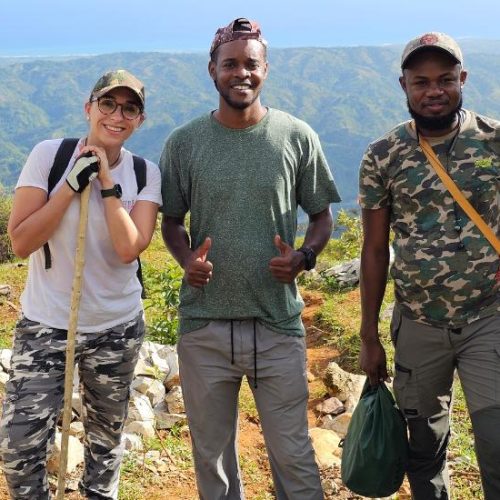
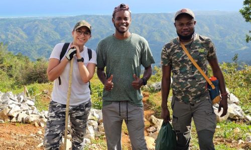
Growing up surrounded by animals, Anne-Isabelle Bonifassi always dreamed of a career in conservation. Today, as Executive Director of Haiti…

23 July, 2026
How the Caribbean Cetacean Society, with the support of BESTLIFE2030, aims to translate scientific knowledge into policy, and why this…